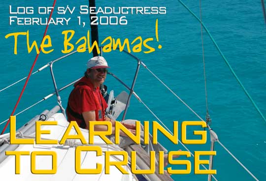
Wednesday, February 1, 2006 - Rodriguez Key
We are anchored at Rodriguez Key tonight, having traveled about 50 miles east in the company of Promise and Misty Blue. There are a dozen other boats here (two trawlers, the rest sailboats) and I suspect many are in route to the Bahamas as we are. Our plan, assuming everything holds together, is get a start at 3:00 AM, which should put us into Cat Cay around 1:00 PM.
Thursday, February 2 - Cat Key, Bahamas
I woke up at 1:00 AM, an hour and half before the alarm went off, strangely anxious about the Gulf Stream crossing. The forecasts were ambiguous (and perhaps, like the guidebooks, we had too many of them, all predicting different versions of the same events and places). The stream is a relentless river of water moving north at 2-3 knots, and when wind goes against that kind of moving water, the seas get mighty cantankerous. Our weather window was a pre-frontal flow of wind from the southeast, which was more or less in harmony with the flow. At 3:00 AM, our three boat convoy moved out, motoring slowly past Molasses Reef and into the open Atlantic. By the time the sun came up the cobalt blue seas were getting larger and it was clear that the optimistic forecast of 2-3 foot seas (pretty good for a crossing this time of year) was just wishful thinking. We should have believed the forecast for five foot seas that none of us had wanted to hear. Sailing is not like surfing, where you get points for riding the biggest waves. In fact, the culture is similar to hang gliding, where good judgment is respected far more than reckless courage.
Conditions weren't very comfortable, but certainly bearable. Winds were 15-20 from the southeast, just the hint of a howl in the rigging. We were beating into four foot seas, with an occasional larger wave knocking us about and putting spray over the dodger. We motorsailed on a heading of about 90 degrees, letting the Gulf Stream push us north, rather than heading to a fixed waypoint. Laura spent the day in the aft cabin watching Spongebob. Annie and I were in the cockpit with occasional trips below to bounce around like pinballs if we dared to let go of our handholds. Well out into the Florida Straits, someone mentioned a ship so I turned on the radar and saw six ships crossing ahead or behind us. In mid-morning we rolled out a bit of genoa and turned off the motor to sail for about three hours. This saved a little fuel but as Annie pointed out, the increase in heel made it far more difficult to move around below decks. For once, Seaductress was in no danger of running aground. Depths were well over 1,000 and sometimes 2,000 feet as we made our way across.
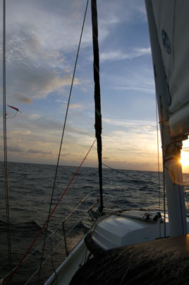
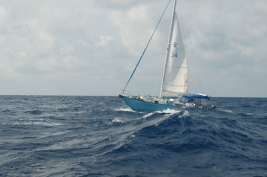
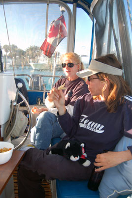
Photos: (1) Pre-crossing strategy meeting the night before. (2) Early morning in the North Atlantic. (3) Misty Blue is being swallowed by a wave.
Shortly after 3:00 PM we arrived at Gun Cay, Bahamas after taking 12 hours to cover 70 miles, a bit slower than we had predicted. The inlet between Gun and North Cat Cays--maybe 150 feet wide between the rock cliff of Gun and the coral heads on the Cat side--had some small breaking swells coming in, so we powered through as quickly as possible. Passing four boats anchored just off the runway, we entered the Cat Cay Yacht Club harbor and were assisted in tying up by a friendly Dockmaster named Radar, who also provided the customs forms we would need. Cat Cay is a beautiful place, but the island is a private club and we are pretty much restricted to the marina area. After clearing customs, the crew of all three boats ate at the restaurant to celebrate our arrival. Once again, Annie and I were too tired to open the bottle of champagne we've kept chilled now for months.
Annie says: The blue water in the gulf stream was everything I had heard. It was also very wavy. And quite wet. But still not as bad as it could have been. It felt exhilarating to finally arrive in the Bahamas. Laura is so excited. Well, so am I.
Sunday, February 5 - Cat Key
A strong front came through last night with thunderstorms and 25 knot winds, keeping us at the dock at Cat Key. Our original plan had been to push on across the Banks the day after we arrived here--the marina here is $2.50/foot--and indeed the other boats who were anchored just outside the marina did just that. However, everyone was tired and the boats seemed to want some attention. I spent a couple of hours looking for any ground leaks in the boat after checking the zinc on the shaft and finding that most of it was gone. Once I eliminated the battery combiner and bilge pumps, the multimeter showed no evidence of a leak. My frustration with the Icom 802 SSB radio continued as most stations are very weak. Like everyone else I thought the problem was likely in the ground but having performed the "ground overload" test, I'm not so sure. The overload test consisted of connecting 25 feet of submerged three inch foil to the antenna tuner, both alone and in conjunction with the existing foil on the boat. These connections made no difference whatsoever, so I can't imagine the ground is inadequate. I think the problem is either in the antenna tuner, the radio itself, or the coax that connects them.
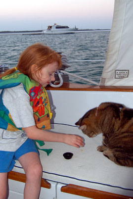
Although the island is private we were able to dingy south of the runway to some sand banks that were drying out at low tide. Laura had a great time running around and we encountered lots of starfish. In the evenings we've been enjoying happy hours with Janet, Rhonda, and Doug. In fact, those visits have been one of the best times we've had here in the Bahamas.
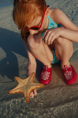
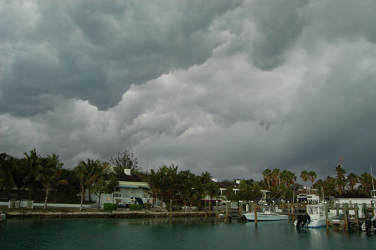
Photos: (1) Janet and Rhonda. (2) Starfish encountered on our dingy exploration. (3) Stormy front approaches. This weather helped sink the Princess Gigi, a 125 foot luxury yacht. She went down the night of February 5 east of San Salavador, Bahamas when they lost their engines and started taking on water in confused seas.
 We filled our jerry cans with fuel ($3.66/gallon for diesel, ten gallons for us at 282 engine hours) and checked out of the marina this afternoon, so we're set for an early morning departure tomorrow across the Great Bahama Bank. It's 110 miles to Nassau, too far for us to make in one day of travel, so we plan to anchor out about halfway across on the banks. The banks are a vast area of shallow water, averaging around 10 feet deep, that will be our first real "eyeball navigation" challenge. Here the GPS is still helpful but the most important tool in navigation is a pair of polarized sunglasses to pick out the deeper water. Fortunately, we've heard the obstacles on this end are primarily sand banks that can cause a temporary delay rather than coral heads which can do real damage.
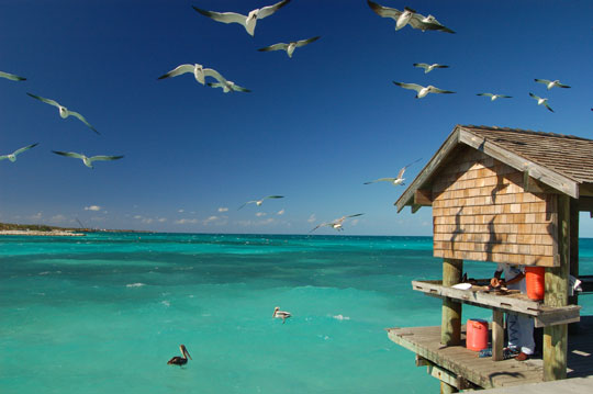
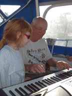
Photos: (1) Doug is a talented musician. (2) Gulls soaring the fuel dock at Cat Cay.
Monday, February 6, 2006 - Middle of Nowhere
As I write this we are rocking at anchor in the open ocean of the Great Bahamas Bank, sixty miles east of Cat Cay near the Northwest Channel light (which I am proud to say is operational). It's a strange feeling for a Tennessee sailor to anchor out of sight of land but within sight of the bottom, where you can look down and see your anchor below. Our three boat armada left Cat Cay Marina at 7:00 AM this morning, motoring directly into a weak east wind. By late morning we had been passed by the Hylas 64 Saint Dion's Grace which had left the marina hours after us, along with a couple of big power yachts and sport fishing boats.
Today we had our first real pod of dolphins on the bow, at least six of them. I also caught my first fish, (thought it was a Barracuda in my ignorance so we let it go, only to find out later it was a 20 inch Cero Mackerel!). And only one day after the Super Bowl (I know it was yesterday, although I have no idea who was playing) we recovered a mylar Super Bowl balloon that was adrift out here in the middle of nowhere. And Annie got to watch an episode of Green Acres she had never seen before, which is a pretty special event for someone of our generation.
Tomorrow we plan to get another 7:00 AM start and cautiously work our way out past the coral heads into the deeper waters that lead to Nassau.
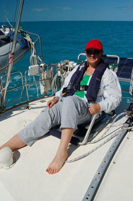
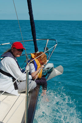
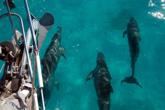
Photos: (1) Today was nothing like our Gulf Stream crossing. (2) Laura loved getting wet at the bow. (3) Alas, when the dolphins realized we were motorsailing, the pod broke off abruptly and disappeared.
Tuesday, February 7 - Nassau
Today we had the deepest and calmest seas we've seen in the open waters. As we motored off the banks just after sunrise, the winds looked good for a close reach towards Nassau, so we spent ten minutes getting the sails up and pulling. Three minutes later, the wind clocked into our faces and then died entirely. As we motored south in the incredibly blue, incredibly deep water (the chart showed over 9,000 feet at one point), I made another attempt to scale the mast while underway and found it was an uncomfortable ride. This time I got up to the second set of spreaders. No fish today, although we trolled most of the way. Late in the day, however, we did reach another milestone when after months of trying, I finally received a weatherfax using the SSB radio and JVCOMM32 software (turns out I had to apply a rather extreme "slant correction" to get an intelligible picture).
Coming into the busy Nassau Harbor, Annie noticed that we could see the bottom some 50 feet down. It's quite a place. Not all the boats are operating under normal safety guidelines, and we were the only boat in sight obeying the 5 knot speed limit. We're at the dock at Nassau Yacht Haven tonight and most likely tomorrow night before crossing the Yellow Banks to the Exumas. The docks here are a bit rolly, but an improvement over the open waters of the Banks. Lots of friendly people about.
Annie says: We started the day with a beautiful sunrise. I don't see many of those; they come too early. We had the deepest and smoothest waters we have seen since we got to salt water. I could see the clouds and planes reflected in the dark blue water. The flying fish were everywhere. It actually got hot today behind the dodger and we had to open it up. (I hear there has been a hint of snow in Chattanooga.)
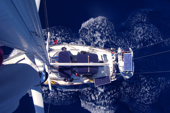
Photo:Looking down from the second spreaders at several thousand feet of water.
Next Two Weeks | Previous Two Weeks | Start of Log


Copyright © 2007 by Rodger Ling.
All rights reserved.
