March 8, 2007 - Staniel Cay
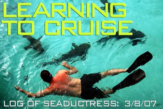
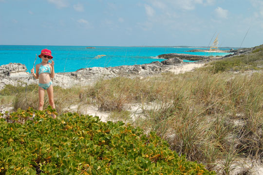
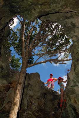
The title photo is from the marina at Compass Cay, which we hope to revisit with Krissy and Robert when they arrive later today. We also have an alternative title shot taken in the Bat Cave.
We had a fun time last night visiting with our old Coconut Harvest buddies Bob and Sally from Endaxi and a lot of other folks at a happy hour someone organized at Big Majors.
March 9, 2007 - Compass Cay
I was a little worried yesterday that Krissy and Robert might not arrive exactly on schedule, especially after I made a reconnaissance visit to the airport. The main building is a pavilion next to the runway, where I found Larry from Exuma Park waiting for an early morning flight. Unfortunately, it was no longer early morning. He assured me that the planes usually showed up, eventually.
You can imagine our excitement when the five-passenger Flamingo Air flight arrived almost on schedule that afternoon. We bought the boat into the dock at Staniel for water and fuel (just seven gallons) and then anchored for what turned out to be a windy night at Big Majors. The pigs were quite mellow when we visited them at the beach, and we got to see a mother with about five babies.
Today we came into the dock at Compass Cay and had a fine, exhausting day. Everyone hiked north to Rachael's Bubblebath while I took the dinghy up, then Annie and I hiked back down. Later Robert and I went snorkeling at His & Hers Cay and over in Pipe Creek, then joined Krissy and Laura to swim with the nurse sharks at the dock. I had a slight misadventure with the video camera when the housing leaked. Apparently I did not get the latches sealed properly, but in my defense I had sharks nuzzling against my legs at the time. My legs survived the experience but the video camera did not.
Actual quotes from satisfied participants:
The Hike: "It was so nice I did it twice...the trail was littered with lizards...little hilly for us pregnant women."
Rachael's Bubblebath: "Best bubbles ever...the water was unexpectedly cold...where else can you get up to your neck in water and not be afraid of sharks?"
Swimming with Sharks: "They tickle...don't step on their tails...they were as docile as a park bench."
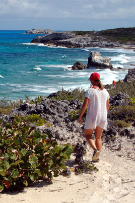
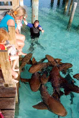
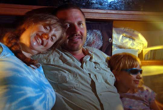
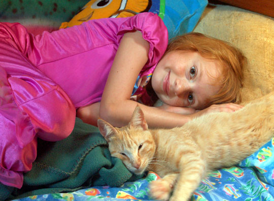
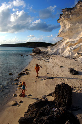
Photos: (1) Hiking south from Rachel's on Compass Cay. (2) Robert was tickled by the nurse sharks. (3) Laura with her Aunt Krissy and Uncle Robert.
March 10, 2007 - Compass Cay
Another busy day, with lots of activities including birding, fishing, snorkeling, hiking, and grilling veggie burgers on the dock...once again everyone but me is fast asleep well before 9:00 PM, and I hope to follow shortly.
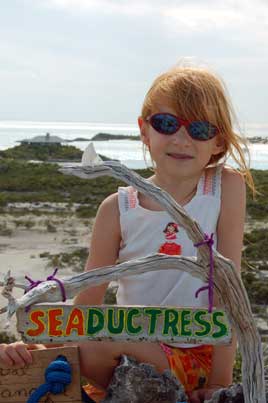
We left the marina at mid-morning and headed around Compass and out Conch Cay Cut near the Rocky Dundas (there seemed to be plenty of water on this route if you stayed close to Compass) and then out into Exuma Sound for a brief interlude of waves and spray. Then we went back in O'Brien Cut alongside Bell Island, cut around the north side of Pasture Cay, and anchored Seaductress in a big patch of sand just south of the sunken Cessna (alas, now unmarked) about a third of a mile from the Seaquarium. The idea was to get as close as possible since the mighty dinghy would be somewhat overloaded. This plan worked fine and we had a great snorkel.
Once safely back at the dock at Compass Cay, Krissy and I took the dinghy about a mile south to the ruins of the old DECCA Station. We toured the station without ever figuring out what it's purpose might have been. Later, thanks to Compass Cay's high-speed Internet service, I did a Google search and learned that DECCA was a differential radio navigation system that was used from the 1940's until around 1970 when Loran and finally GPS took over. There were stations on Andros, here at Pipe Cay, near George Town, and on Eleuthera.
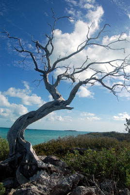
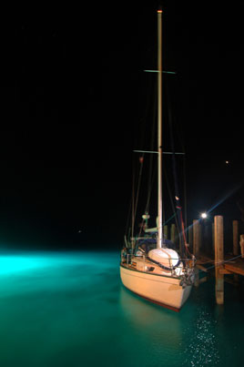
Photos: (1) Laura was very pleased to wake up and find that her friend Compass, the staff cat at the marina, had come aboard. (2) Tree on small cay west of Pipe Cay. (3) A big Hatteras called Sound Waves had their underwater floodlights on, lighting the entire area, so I couldn't resist a photo of Seaductress at the dock.
March 12 - Bitter Guana Cay
Funny how even a small boat seems empty after some of your favorite people depart. Krissy and Robert flew out of Staniel Cay this morning after their short but very busy visit. Compass Cay was an excellent place to center our activities with them; everyone enjoyed the hiking trails and of course swimming with the sharks.
Yesterday after we left the marina we pretended that Seaductress was fishing boat and trolled around the banks, trying to drag the lures across coral patches without dragging the boat, too. It worked! Within a few minutes, Robert had landed a Yellowtail Snapper. Although the other fish we caught was less useful (a Great Barracuda that we let go after taking pictures of his inch-long teeth), we did manage to see some new territory. After we found ourselves just outside Sampson Cay Marina, I decided to continue our route behind Fowl Cay, then between the Majors, so we ended up sneaking up on Staniel Cay from the other side. You definitely want your Explorer charts handy and your polarized shades on for this route. After a debriefing at Pirate Trap beach, we snorkeled Thunderball where everyone saw new and amazing things.
Following our guest's departure, we went down to Black Point to do laundry, finding that about three dozen other boats had the same idea. With the laundry complete by late afternoon, we went north to Bitter Guana Cay, about halfway back to Staniel, where we now have a beautiful anchorage all to ourselves. We took a walk ashore on a magnificent beach with its towering cliff and were greeted by a three foot rock iguana.
Photos: (1) We anchored just off a lovely beach at the north end of Bitter Guana Cay. (2) The beach reminded me a little of the California coastline. There was another very cool little beach on the ocean side where a SCUBA cylinder, still full of air, had washed up.
March 13, 2007 - Compass Cay
We ended up back in our customary spot outside the entrance to Compass Cay Marina, bunkered down for 20 knot plus winds tonight. Our spot off the beach at Bitter Guana was well suited for the weather (I'm not clear why the Pavlidis guide says to anchor there only in calm or light easterlies...we did fine last night in 20 knots). But we wanted to move north, even if just a little, so we pulled anchor and had a brisk sail up to Pipe Creek. We had never been inside the southern entrance to Pipe Creek, so in we went on a rising tide. Several boats were anchored in a narrow channel between The Mice and Rat Cay, but we were hoping to get over to Thomas Cay where a trawler was sitting. This task proved difficult, but we found we could continue north fairly easily, with just one squeeze over a coral bar. We anchored off the entrance to the flats at Joe Cay, but I wasn't happy there so after lunch we continued north through heavy swells to the channel up to Compass Cay.
Ironically, the only problem we had came just as we reached the edge of the deep blue water. "We're going to make it!" I exclaimed, by coincidence just as the keel started dragging the bottom. We were still moving, so I gunned the throttle and we plowed through the last foot of a sandbank to pop out the other side. Looking back with the light in our favor, it was obvious that I had gone to the wrong side of a channel marker. Yes, after an hour of threading our way through coral heads, I went on the wrong side of a colored channel marker...this is why I'll never get that promotion to second mate.
We've been in and out of Compass so many times now that I guess we just got tired of going the easy way.
March 14, 2007 - Warderick Wells
We're back on mooring #21 after a rousing sail up the banks this afternoon. In the morning, while still anchored between Pipe and Compass Cays, we saw two rather unique sailing craft pass by, heading north. Their boats looked like big, twin-pontoon whitewater rafts with sails, each carrying about a half dozen people. They had arrived at Exuma Park not long after we did, and I promised to send them some pictures. The group had flown into Nassau (the boats pack very well), arranged for an overnight trip on a fishing boat down to Little Farmers, and were to be picked up by the same boat in the northern Exumas. Along the way they were camping on the beach. The biggest problem seemed to be getting out of the wind while sailing; several in the group were in wetsuits as they sailed away. Postscript: I later got a couple of e-mails from these folks and learned that they had ended up making a very rough night crossing of the Yellow Banks to sail all the way back to Nassau. "Some folks are a little frightened of sailing these things out of sight of land," I remembered their leader joking. "But if we go at night, they'll never know the difference!"
We took the mooring intending to stay for just one day but will probably stick around until a front comes through this weekend. The plan is to get back to Florida by the end of the month, but the winds will be strong for several days after the front, so we may be in the Exumas for a while longer. Yeah, it's a tough world.
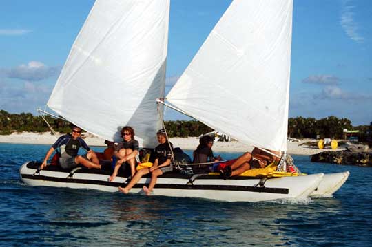
Photo: One of the sailing inflatables leaves Warderick Wells (click on it for more pictures).
March 15, 2007 - Warderick Wells
I've used the park's recently enhanced Internet access (good wireless coverage even out here on our mooring, $10/day) to do a lot of reading about Haiti. Lately it seems that everywhere we've been has had some connection to the ongoing Haitian tragedy. The result of all this rumination is a new essay.
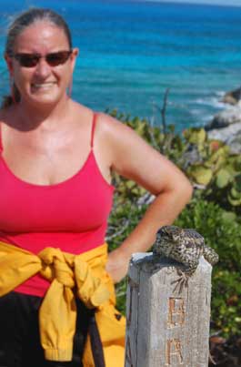
Photos: (1) We had to bring our sign down from Boo Boo Hill for maintenance. Here's the sign repainted with fabric paint that should last a lot better than the water-based stuff we used last time. (2) I'm not exactly clear how the crew of Hum 2 trained this lizard (just to clarify, that's the lizard in the foreground, Annie in the background) to sit on top of their sign all day, but it sure looked cool.
March 18, 2007 - Warderick Wells
Warderick Wells is always a great place to hide out for a while. We love the hiking trails, the bananaquits that will land right on your hand, the colors, the curly-trailed lizards, the friendly people. We've delayed our departure once or twice already, waiting for the winds to shift back to the east...but tomorrow is looking like the day to move on. If possible, I want to spend some time at Shroud, Normans, and the little store at Highborne.
One thing that Krissy commented on while she was here is that the wind never stops. You know, she's right. The wind blows constantly this time of year, rocking the boat, rattling the track up our mast. Of all the things I would do differently when outfitting the boat, I think a wind generator tops the list.
Photos: (1) A day of hiking at Warderick Wells is a part of a well-balanced cruising diet. (2) Laura likes climbing down in Murphy's Hideaway, one of many deep holes in the island's limestone. (3) We called this big hole on the trail to Butterfly Beach the "tiger trap."
March 21, 2007 - Shroud Cay
We spent the first day of Spring at Shroud Cay. Actually, this is the third day we've spent here. We left Warderick Wells on Monday and sailed here in a couple of hours, delighted to meet our friends on Magic along the way. Larry has entertained us, Victoria has treated us to a couple of fantastic meals on board their spacious vessel, and Laura has had a great time playing with Samantha. Yesterday was rainy and windy all day, but under heavy sunshine today we did a dinghy trip up the creek to the ocean side of Shroud and then over to Camp Discovery, the former home of a hermit who reportedly lived like Robinson Cruso. Last year Camp Discovery was looking rather trashed, with a lot of bottles and boat signs, and I was pleased to see that the folks at Exuma Park had cleaned all of that up, leaving only the incredible view from the hill and a single sign that read, "Please do not leave momentos or other items here." Alas, some clever but apparently illiterate person from the mega-motor-yacht Janie had left a commemorative t-shirt draped and tied over the sign. Guess what? We now have a new t-shirt to wear.
A year ago, we were anchored off Mayaguana and Annie wrote, "Sometimes I think briefly about what we will do when we are 'through' cruising. But that seems so distant from where we are now, that I can't really make sense of it." Today, as we wait for a window to cross back to Miami, our return to the American version of reality is focused all too clearly in front of us. This year we encountered several couples our age with children, all of whom had gone cruising for the same reasons we did, all of whom said they had no idea what they would do when they returned.
This afternoon Annie accused me of deliberately delaying our return (as if I had had any control of the 25 knot northeasterlies we've had for a week now!) but in truth I am only trying to make the best of what we have left. After we hit Florida we have talked about trying to visit the Dry Tortugas, then making a beeline up the Gulf for home. I wish I could say I was coming back a better person. Tonight, anchored off Shroud Cay on the first day of spring, it's cruel enough just to say I'm coming back.
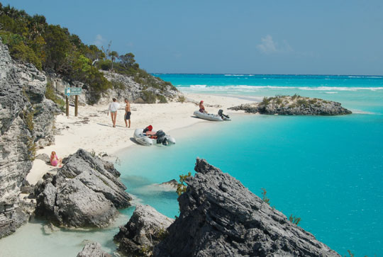
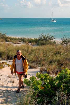
Photo: This spot on Shroud Cay, near Camp Discovery, is one of my favorite places in the world, and sometimes I can't for the life of me remember why we don't just stay here forever.
Next Two Weeks | Previous Two Weeks | Start of Log

![]()
Copyright © 2007 by Rodger Ling.
All rights reserved.
