Next Two Weeks | Previous Two Weeks | Start of Log
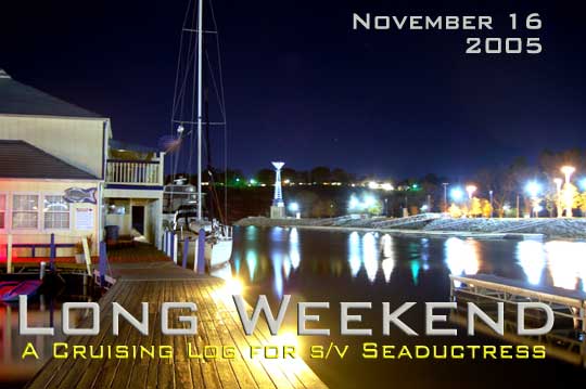
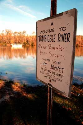
Wednesday, November 16, 2005 - Florence
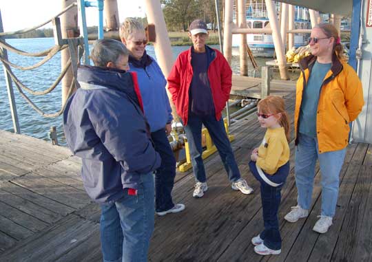
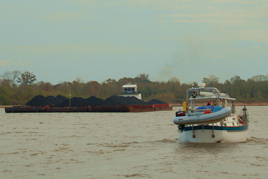
We had enjoyed our time at Wheeler State Park, except perhaps for the storm the previous night, but we were ready to move on. We locked down at Wheeler Dam after waiting about an hour for a commercial tow to lock up, then powered into a chop on Wilson Lake that eventually turned into two foot seas as the post-frontal northwest wind (right on our nose, of course) gusted to over 20 knots. When I called the lockmaster at Wilson Dam, just 15 miles downstream from Wheeler, he mentioned something about another tow coming up and some maintenance on the lock. With his permission we tied up to the auxiliary lock wall and waited.
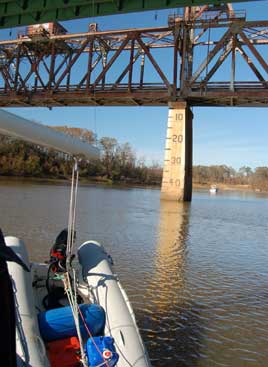
Going through locks is one of the unavoidable realities of traveling from Tennessee to the Gulf of Mexico. Wheeler was our fourth lock, with another 13 to go. The general procedure is to radio the lockmaster before you arrive so he or she can prepare the lock and you can judge how big a hurry you should be in to get there and wait if the lock is already in use. The lockmaster will sound a horn and a traffic light will blink green when it's safe to enter. Then the trick is to get your boat up next to a floating bollard in the wall so you can loop a line around it. If there's any wind in the lock this can get tricky fast. We like to have a single line from the bow to the stern that we loop twice over the bollard. As the big doors close, we take positions with our boat hooks to fend off the slimy walls as the water, bollard, and boat all begin to drop.
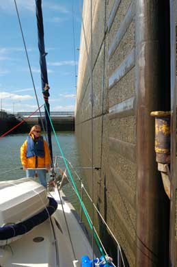
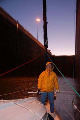
Photos: (1) The warm, bright Wheeler lock showing bollard. (2) Inside the much darker and rapidly cooling Wilson lock after our long wait.
At Wilson, I didn't get the boat close enough to the bollard and we had to power back and forth for a minute trying to grab it. Perhaps we were just tired and cold after waiting three hours for a series of three 250 foot barges full of benzene to lock up and reassemble. Once again we were locking through at sunset and facing arrival at our next stop in darkness. The Wilson lock is the deepest on the river (reputed to be 97 feet) and is unique because the upper lock door slides up and down in a submarine fashion rather than opening and closing like cabinets.
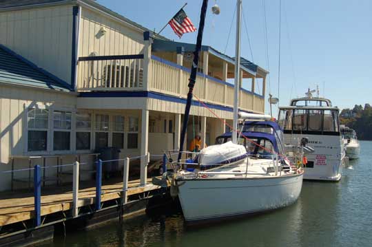
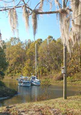
A couple of miles downstream we turned hard to starboard to enter the Mystic Harbor Marina in Florence. I had called to alert them we were coming, but by this time the office was locked and no one was to be found. We snugged the boat in next to a building where we had found an unmetered AC outlet, desperate for shore power to fuel our electric heaters because temperatures are forecast to drop into the 20's tonight. From what we can see from here, Florence is going to be a fun stop.
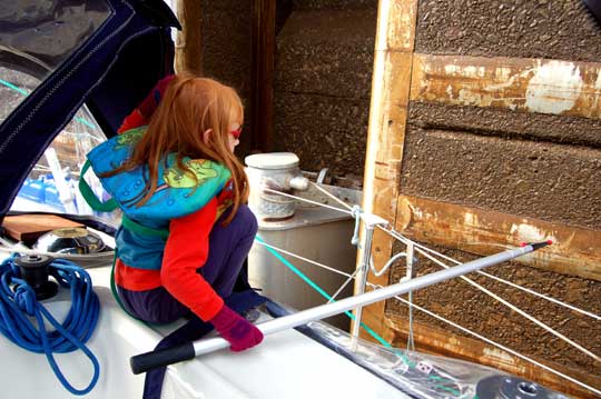
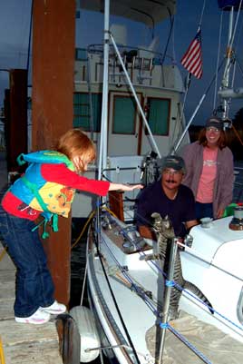
Annie says: I am the cowgirl that gets to lasso the floating bollard as Rodger pilots the boat close. The bollard floats in an eighteen to twenty-four inch recess in the wall. Not always an easy target. Between problems with the rope getting twisted and the boat drifting away from the bollard, I have been known to let loose a few expletives. I have come up with a plan to try a different method. It involves a boat hook and some controlled friction. We'll see how it works.
Thursday, November 17 - Florence
There's a great playground under the bridge out at the river. That and a reputed Quiznos somewhere nearby have convinced us to spend the day here before making an early start (before Noon, that is) tomorrow for Yellow Creek and the Tombigbee Waterway. We used the marina courtesy van to get to the nearby downtown (the walk would have been close to a mile and it was cold) but also took in the public library where we checked our e-mail.
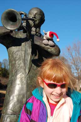
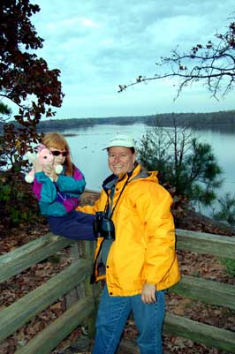
Photos: (1) Entrance to Mystic Harbor at Florence. (2) W.C. Handy meets Laura and Rollo. (3) There was a restaurant and a bar atop the marina office (both closed for the season, which was a good thing for us).
Friday, November 18 - Aqua Harbor
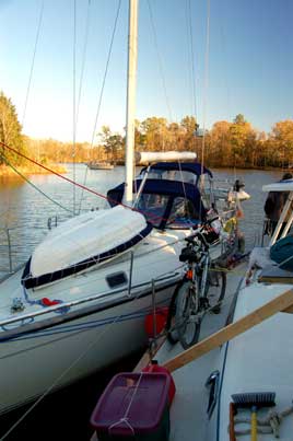
This evening we are docked at the start of the Tenn-Tom Waterway at Aqua Harbor Marina. After a tasty dinner at the marina restaurant and a movie aboard, we opened a celebratory bottle of "Blueberry Hill" from the Log Cabin Winery of Steve and Beth Dodd to celebrate. We'd taken on 10.6 gallons of fuel at Florence before departing (still averaging around 10 MPG or 1/2 gallon/hour, 48 hours total on engine since Sale Creek) and had an uneventful trip down, although I wished we could have spent a night at Cooper Hollow, a few miles upstream from here. The anchorage features a cascading waterfall and what looked like a nice little beach, but with temperatures forecast again for the mid-twenties, we preferred to have our electric heaters operating. Aqua Harbor is a big, modern marina with a decent playground and many very nice boats. The sailboat dock includes lots of late-model or interesting boats in what looked like a Stone Horse, a San Juan 33, and an S2 11 meter. We toured a 2005 Catalina 42 belonging to a nice fellow named Rick that was still boat-show new. There are lots of mega-yachts of the powered variety but few liveaboards; most of the big boats belong to folks out of Memphis, we're told.
The interesting sights along the river downstream of Florence included a number of small unmanned johnboats flying diving flags operating in the shallow water on the edge of the channel. The divers were working the bottom and often, it seemed, pulling the boat along behind them. What were they finding down there?
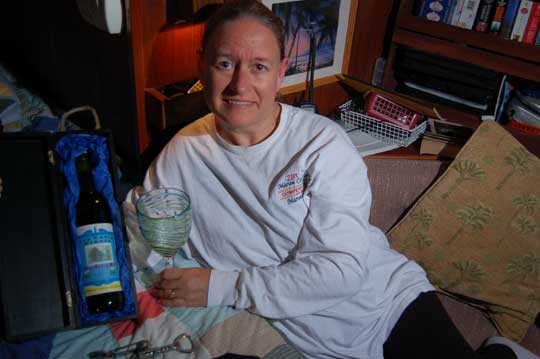
Photo: We celebrated with that great going-away gift we had gotten from Steve and Beth Dodd. Yum!
Saturday, November 19 - Midway Marina
After reading Sheila and Godwin's log about their trip down some years back, I was ashamed to see how they had managed days of more than 70 miles, with one 91 mile day. In truth, it took us two weeks to get as far as they did in their first four days. So today we got up a bit earlier and were actually underway by 8:30 AM local time. We spent the morning transiting the "Divide Cut," a costly 25 mile section which connected the Tennessee with the Tombigbee. The "cut" is a straight, narrow canal but has plenty of room to pass the occasional barges (although we saw only three all day). At 2:00 PM we were at Whitten lock and facing a decision: stop at Bay Springs Marina or push on through a total of three locks towards Midway Marina. The lockmaster said he could have the lock ready shortly, so on we went. The route from here on was through a series of wide, scenic lakes.
Montgomery Lock was just five miles past Whitten, with Rankin Lock another eight miles further. The lockmasters at both of these had the locks ready, open, and waiting for us when we arrived, so we got though with little delay. Midway Marina was just four miles further, and we arrived just in the nick of darkness after a 54 mile day. Fortunately, dockmaster Pat Sisson was there to help guide us in. For $30/night for our boat (about the going rate so far, except for Wheeler State Park which was half that) this place has everything, including a warm "cruiser's lounge" with a shower, games, laundry, cable TV, and wireless Internet. The outdoor hot tub is steaming and ready to go, although Annie expressed doubts about using it in this weather. We ate catfish at the restaurant and then it was off to the lounge for laundry and Internet (didn't succeed at the latter).
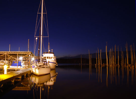
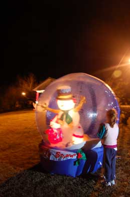
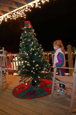
Photos: (1) Midway at night. (2) They had one of those best-selling inflatable snowglobes, too. (3) It really is beginning to look a lot like Christmas, even though we haven't even found a Tofurkee for Thanksgiving yet.
Sunday, November 20 - Aberdeen
After making sure the lock was ready for us, we got an early start from Midway and were followed by the Grand Banks 42 Popeye, whom we'd seen at Wheeler, and another large motor cruiser. We did three locks and 36 miles before veering off just before a fourth into the center of the winding entrance channel to Aberdeen Marina. Even as the marina assured me over the radio that the channel had at least six of feet of water, it took three tries to get into the thing (shades of Ditto Landing here) because two-thirds of the entrance was shoaled to less than five feet. At the dock, we ran aground twice more before finding a deeper spot. There was an hour of daylight left--time for a field trip! We lowered the Nemo and went for a quick trip back out the channel and across to Blue Bluff Recreation Area. This was a fun little hike up from a dock up a series of stairways to the top of a 100 foot bluff.
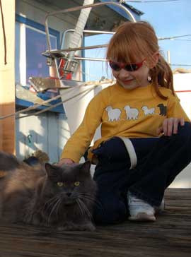
Aberdeen was a good stop because the facilities are basically a standard convenience store (in fact, the store is right there on a highway), although we were surprised when the store closed soon after dark. We didn't purchase any fuel, but heard the prices were among the lowest around at $2.17/gallon for diesel (we had paid up to $3.50/gallon elsewhere). Laura was delighted to be visited by M.C. (Marina Cat), who came aboard and was under the Walker Bay dingy, walking across the hatch over Laura's bed in the morning. She was later lured into the cockpit but (probably wisely) declined to come below.
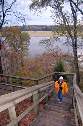
Photos: (1) Laura usually helps out at the locks. (2) The stairs at Blue Bluff. (3) The view from the top of Blue Bluff. You can't see Aberdeen Marina, but it's behind the trees in the far distance.
Annie says: What a great day. We saw an eagle, a wild turkey and the first great egrets on the trip. The three locks we did today had a different quality than the others. At each of the locks the lockmaster would walk out to inspect the gate after it closed us in. This was not done at any of the previous locks. The lockmasters also insisted that we all wear life jackets. Again something that had not been stressed previously. Then there were the eerie sounds. The bollards creaked, groaned and screeched in their wells as the water dropped. Combine the sounds with the echo effect of the lock and it felt like we were in some sci-fi movie.
Monday, November 21 - Marina Cove
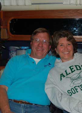
Today we motored through a morning of cold rain (the full cockpit enclosure again proves its worth) through three more locks and 51 miles of mostly canal to reach Marina Cove just upstream of Tom Bevil Lock and Dam. Today was the first day we've seen cruising sailboats. First we saw a small red boat at anchor, then came up behind The Beaver, a 25 footer headed for Florida, which whom we shared a lock. At Marina Cove, most of the half dozen boats at the dock seemed to be cruisers, including two sailboats. After dinner we went over and had a fun visit with Steve and Gloria on the Irwin 42 Living Well, which Steve has cruised and lived aboard for the past 16 years, We soon discovered that Steve was a master craftsman and his highly-customized, spacious craft had everything:
- 55 gallon/hour watermaker.
- A washer/drier
- A table saw.
- Two recliners in the salon.
- An on-board winery and cellar with room for 90 bottles.
- A theme song.
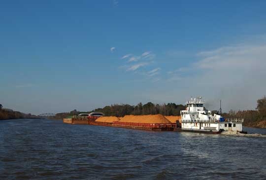
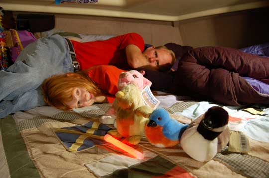
Photos: (1) Some of the commercial traffic, like this towboat pushing three barges abreast, look pretty huge, but so far there has always been plenty of room to pass. They're friendly and usually just say, "See you on the one!" when you ask how they'd like you to pass (for you landlubbers, this means just to stay to the right). (2) Tuckered out after a Glowstick Party with Laura and her friends.
Tuesday, November 22 - Sumter Landing
Five boats--trawlers Integrity and Pelican, and sailboats Catnip II, Living Well, and Seaductress--left Marina Cove after receiving word that the lock was ready. The Beaver was waiting nearby. As we were about to clear the channel from Marina Cove, I got distracted and suffered the embarrassment of running aground after missing a very obvious red mark. We almost had to be rescued but managed to get off and proceed with what little dignity we had left to the lock. Cruising for me is like hang gliding always was. Just when I think I know what I'm doing, I do something that proves that I still have a lot to learn. I'm not sure which endeavor frightens me more.
As I write this, we are rafted up with Living Well, having traveled some 40 miles down river in our Marina Cove Convoy. The trawler Integrity led the way to Sumter Landing anchorage, but backed out after two attempts to enter saying they had hit bottom twice with their four foot draft. Negotiations produced no other suitable anchorage, so Pelican tried the entrance and got through, followed by Catnip II, which was initially repulsed but sped through on her second attempt. Eventually everyone was inside but the deep-draft Seaductress. The forward-looking sonar simply showed a wall in front of us, but keeping our speed up we plowed in, dragging bottom for around 100 feet before getting into the deeper water of the basin.
We were aground once already this morning. We were aground three times at Aberdeen. We were aground for three days at Ditto Landing. And now we are running aground on purpose.
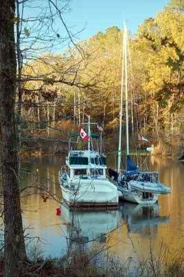
Photos: (1) Pelican and Catnip II raft up at Sumter. (2) Note the bicycles on the deck of Living Well. There is a motor scooter on the starboard rail, too.
Wednesday, November 23 - Demopolis
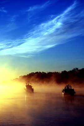
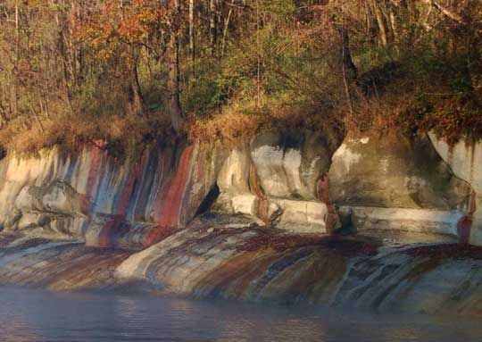
Onward, to Demopolis! Pelican called the lock right on time at 6:15 AM, and soon after we were plowing our way back out into the river. Jerry and Ruby on the Island Packet 43 Wind Dreams, which had joined us at Sumter Landing, was left in solitude as the rest of us headed for the lock. The fog was thick, the rising sun bright, the decks still covered with slick frost. As the miles swam by, the day warmed. The White Cliffs at Epes were as impressive as Fred Myers, author of the must-have Tenn-Tom Nitty-Gritty Cruise Guide, had led us all to believe. It was a pretty day on a pretty, winding river--although one as devoid of anchorages as the guidebooks had promised (this was why we had all been desperate to get into Sumter Landing the night before). Shortly before 3:00 PM, all of us including Wind Dreams arrived at Demopolis Yacht Basin and began circling in the river outside like airplanes stacked up over the Atlanta airport while the marina staff tried to figure out what to do with all of us. Everyone was accommodated, although a couple of boats had to raft with others since the docks, including the fuel dock, were absolutely full.
Dinner at the restaurant here was great (best catfish filets I've had so far on the river). We all enjoyed a tour of Wind Dreams and heard tales of Jerry's other long-distance cruising boat, a jet ski he has been known to ride hundreds of miles. There are lots of very interesting boats here at Demopolis, a cruisers lounge, etc. but we decided that we will push on tomorrow into the unknown. After the Demopolis Lock (only one more after that and we're finally at sea level!) there are no real anchorages, so Thanksgiving should be even more interesting than usual this year.
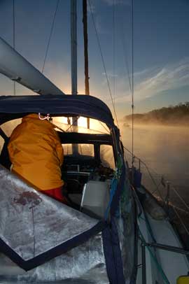
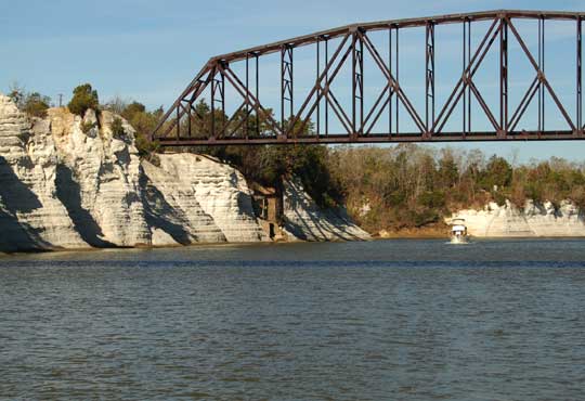
Photos: (1) Early morning departure leads to fog on river. (2) It was cold out there. (3) The White Cliffs of Epes. (4) Girl Talk on the dock at Demopolis. (5) Toby, one of two felines aboard Catnip II with Joan and Mary Lou. (6) Steve and Gloria.
Thursday, November 24 - Bashi Creek
The trouble with bridges is that they always look way too short from the cockpit. So every time one appears on the river's horizon you get out the chart book, check the heights, then scan with the binocs for any markings on the piling to reassure yourself. The railroad lift bridge at Naheola, mile 173.5, was showing around 48 or 49 feet. The top of our mast is 49 feet above the water, with wind instruments and VHF antenna adding another two feet. We hadn't been worried--all we had to do was get the bridge tender to lift the thing--but repeated calls on the radio went unanswered. "I don't believe they man that bridge unless there's a train coming," the captain of the towboat Seldon Hurtt told us. Train cars were sitting immobile on the bridge, it was Thanksgiving afternoon, and clearly no one was going to open the bridge.
 Here we are trying to figure out how to get under the railroad bridge. Looks pretty hopeless, huh?
Thanks for Gloria from Living Well for this photo.
Here we are trying to figure out how to get under the railroad bridge. Looks pretty hopeless, huh?
Thanks for Gloria from Living Well for this photo.
Soon Steve and Gloria arrived on Living Well to assist. We tried leaning the boat over by hanging a water-filled Marlin, our Walker Bay Dingy, from the boom, but the little boat couldn't be made heavy enough for the task. Steve climbed the trestles of the bridge and confirmed that we were just barely too tall. I climbed the mast and removed the wind instruments. We tied Steve's larger dingy to the boom, concentrated all our physic energies on leaning as hard as we could, and slowly drifted back under the bridge. The top of the mast and VHF antenna scraped underneath and we emerged on the other side, the antenna bent but the rig otherwise undamaged. Annie and I were exhausted, and the delay had cost all of us the daylight advantage. We navigated the last hour in darkness, relying on radar and spotlights to find Bashi Creek, an anchorage that was reputed to have shoaled to four and a half feet at the entrance. A lucky break: the shoal was gone, and we rafted up in a tie-across with Living Well in ten feet of water. Even without the traditional tofu turkey, our Thanksgiving meal was a feast. We had much to be thankful for, but especially for Steve and Gloria, who had been kind enough just to take us under their wings and then quite literally had saved the day. When all was said and done, we had set a new record of 71 miles for the day, including one lock and one uncooperative bridge.
Annie says: I baked my first cake while underway today. I wasn't sure how it would turn out, but was quite pleased with the results. It's been two weeks since the last grocery shopping, so fresh ingredients are becoming scarce. That's not to say we are going hungry. For Thanksgiving dinner at Bashi Creek we had Fri-Chik, stuffing w/ gravy, yams and green beans. After all the brouhaha earlier today we had huge appetites and there were almost no left-overs. Who else can say that about a Thanksgiving feast?
Photos:(1) Bluffs just downstream of Demopolis Dam. (2) The
Unmanned Naheola Bridge with Steve's dingy still hanging from our boom. (3) Bashi Creek the next morning.
Friday, November 25 - Old Lock #1
After roaming all around Bashi Creek taking photos, I pulled our anchor and set Living Well free so we could all continue downriver. We meandered down the river, still unwinding from the long day before. Seaductress pulled over at the famous Bobby's Fish Camp for some fuel, but found no one at home--just a note, "Will be back sometime after lunch today," on the door. But Bobby was soon back and after a short chat we took on 19 gallons of diesel (some of which I managed to spray all over myself while filling a jerry can), then rushed off to catch up with Living Well at the Coffeeville Lock. We felt like fools rushing out of a place like Bobby's, which begs for a more leisurely pace, but a tow was waiting at the bottom of the lock.
After a total of 54 miles we rafted up bow-to-stern with Steve and Gloria at Old Lock #1, an anchorage that can sometimes be too shallow but was kind enough to keep a constant eight to ten feet of water beneath us all night.
Annie says: We passed through our last lock today. We finally get really good at something and we are leaving it behind. I saw a coyote today. At first glance, I thought it was a small deer, but the binoculars proved it to be a coyote. A first for me. This last section of the river is interesting in its desolation. We pass a fishing camp or small fishing boat every once in a while, but mostly it's just us on the winding water. And boy does it wind. After all the straightening that was done on the upper Tenn-Tom waterway, you could get dizzy on this lower section.
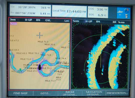
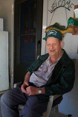
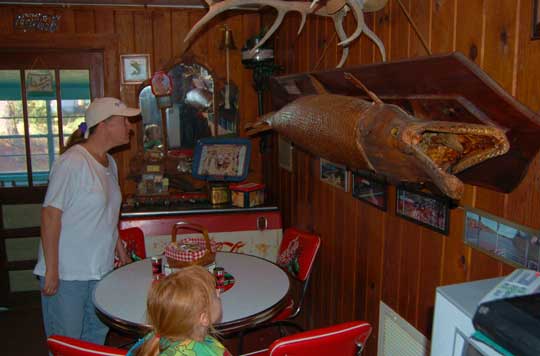
Photos:(`) Twisty river on the Raymarine chartplotter/radar. (2) Bobby Dahlberg of Bobby's Fish Camp, Mile 118.9. (3) Living Well in the river out from of Bobby's. (4) Bobby's Restaurant is full of interesting sights, scrapbooks, and tales waiting to be told.
Saturday, November 26 - Alabama River Cut
On the river again around 9:00 this morning, we seasoned travelers of the river negotiated the twists and turns and towboats with ease, until off in the distance the Jackson railroad lift bridge loomed, a scant 30 feet above the water. "Railroad bridge, railroad bridge," we radioed, "this is the southbound sailboat Seaductress" and then held our breath. A second later the bridge answered and soon began rising. With no more locks, just one more railroad bridge at mile 14 (this one a swing bridge that apparently must open for everyone) sits between us and the Gulf of Mexico.
We made 48 miles before anchoring in the Alabama River Cut, a scant 52 miles from Mobile. It was still daylight, not even 4:00 PM. It almost felt like cheating, finding an anchorage before dark.
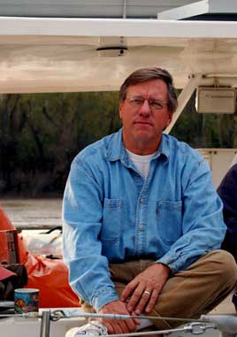
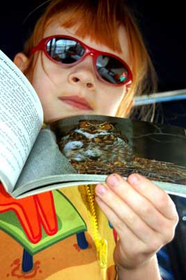
Photos:(1) Steve attempting a serious expression. (2) Laura is becoming a birding expert. (3) The tows are more frequent, but still polite.
Pop the champaign--the first leg of our crusing life is complete. After 26 days, 730 miles, and 121 hours on the engine, we are tied for the night at the fuel dock at Dog River Marina, Mobile. There are boats and sailors of every shape, size, and insurabilty everywhere here at Dog River: Kyle, Kathy, and Dory the Cat on a Tartan 30, about to depart for Belize...Doug on Misty Blue...Steve and Gloria's friend Fish, who has apparently lived all his life on the water. Fish was living on an Irwin 27 until he was given, for free, a Compac 27 with a big hole in its side that had been underwater for two weeks after Hurricane Katrina; he raised the boat, managed to save the engine, cleaned out the mud, and is now living aboard and investing heavily in fiberglass futures.
Everyone says they are glad to be off the river and back into the real world of salt water. As for us, we were downright nervous on the pelican-infested vastness of Mobile Bay, where we powered into a choppy two foot sea through the ship channel. We'd left the anchorage at the Alabama River Cut around 7:30 AM and passed all the milestones listed in the Myers Guide, including a large alligator sunning itself on the banks (Myers didn't actually give a mile mark for this, but had dropped hints). After passing beneath the towering Highway 90 bridge, we'd meekly powered down the ship channel past mammoth hulks of steel loading and unloading, past Waterway Mile 0.0 at the Mobile Convention Center (no place to dock there, which is a shame), past two gigantic hulks aground at Little Sand Island and out into what to us looked like the open sea--Mobile Bay. Dog River is jammed with boats, but the marina and its residents have been most accomodating so far.
Our plan is to rest, then rent a car if we can and visit Annie's family in Hurricane-torn Mississippi, then return and make plans for the next leg of our life and journey on the water.
Photos:(1) What do you suppose this guy pays for a bottom job? (2) Early morning departure from Bama Cut Anchorage. (3) Laura makes friends easily (Kyle, Kathy, and Dory of the Tartan 30 Stap Isi, bound for the Pacific, are shown).
Next Two Weeks | Previous Two Weeks | Start of Log


Copyright © 2007 by Rodger Ling.
All rights reserved.
